Friday, February 21, 2014

South Island Trip 2 Day 4 - Franz Josef Glacier

The next day, we started our trip south along the coast.  The weather cleared a little bit and we got our first glimpse of the Southern Alps from the west side, peaking out from behind the clouds.


A little further on we got our first good views of the mountains from the highway:

There are two major glaciers (pronounced "glay-see-ers" in NZ) that are easy to get to from the west coast highway.  Highway, of course, means something different in New Zealand than it does in the US.  The only major road in the west part of the South Island is SH6, a winding little two-lane road that hugs the coast as the space between the mountains and the ocean gets narrower and narrower.  At several points, glaciers used to come right down out of the mountains and extend into the ocean.  They've retreated since then, but they are still sitting in their glacier troughs and can be viewed after a hike up the moraine.

We first encountered Franz Josef Glacier on our way south.  We all did the hike up to the terminal face of the glacier under a low cloud cover.  The sense of scale during this hike was staggering - the steep walls rise up as you make your way to the face of the natural phenomenon that created the incredible valley surrounding you.  Here is a shot up the valley toward the glacier.

Here are Evelyn and Jasper during the hike.  You can see the gravel under foot that was ground out of the mountains by the glacier and washed into the valley by the rains.

Another photo up the valley:

To give you a sense of scale and size - those are my parents and Jasper at the foot of those waterfalls coming off the valley walls.

To the left is the foot of the glacier, covered in part by dust, dirt and rock:

Some of the many waterfalls that we passed on the way:

My folks, following the DOC green-and-yellow signposted trail up to the glacier.  See, Steve and Halina?  They are doing great!

More waterfalls.  I have plenty more photos of waterfalls - just ask.

Evelyn sitting with Aidan, pondering the epochs that produced the scene around us:

The rocks have this red lichen growing on them, which gives them kind of a pinkish hue.  After reading "Some Facts About Lichens" and "The Lichen Flora of New Zealand," I now know that these are saxicolous lichens and are one of more than 1300 species of lichen in New Zealand.  For more fascinating lichen information, please see: http://nzetc.victoria.ac.nz/tm/scholarly/tei-Bio13Tuat02-t1-body-d4.html

Jasper and I showing what we think about people who dislike glaciers and/or lichens:

My father, crafting a hypothesis regarding the vertical striation of the valley wall.

Looking back down the valley toward the ocean.  The waterfalls and glacial melt created this river that we walked along.

Dad, Aidan, and Jasper - almost to the glacier!

The face of the glacier with the rest hidden by clouds.

Aidan, considering the fate of this and all other glaciers in the face of rising world temperatures.

A group photo with the glacier in the background:

Another entry in the continuing photo essay, Perils of Stickman.  In this image, we can imagine Stickman crushed either by a giant white thing or many small black things.  In either case, we admire Stickman for the way he seems to be rushing headlong into danger, even as we know he will surely be crushed.  The white and black images represent the yin and yang of Stickman's perils, the symbolic universe crushing him as he raises one arm awkwardly in defiance of his fate.  White, black, it makes no difference - Stickman is doomed, and yet he carries on, one leg much longer than the other.

A good shot of the glacier - imagine the rest of the massive ice sheet extending up beyond this terminal face.

My mother, back against the ropes, ready to head back out into the ring and take on the glacier.

A cool photo of the rock face on the valley wall:

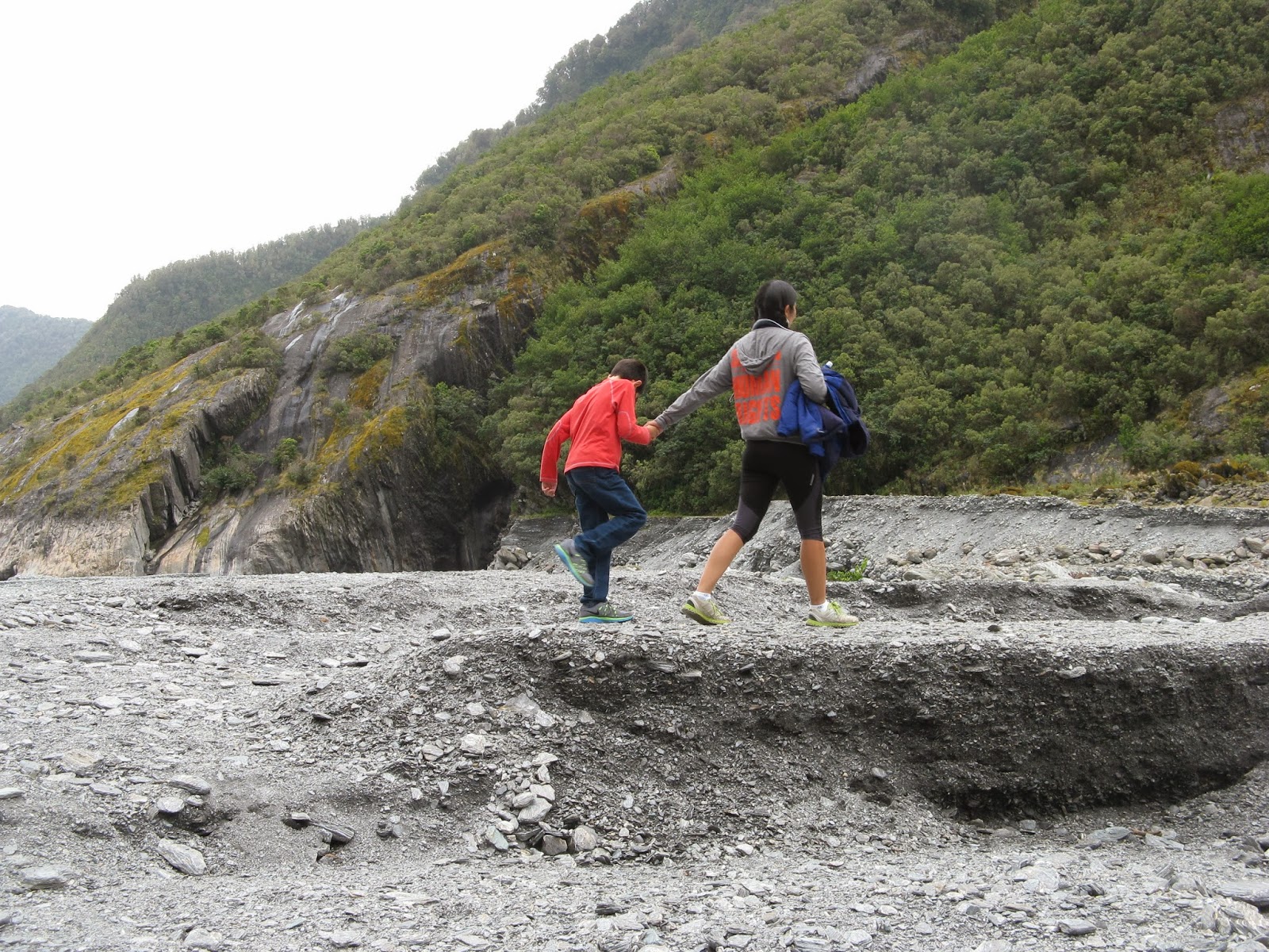
Aidan and Evelyn skipping back down the trail

A close up of the river running alongside the trail:

We stayed in the Gecko House.  It was not very gecko-y.  Here are the boys, playing a game, while I pass out.  You can see the worst Jenga set in the world on the table.  The pieces were not terribly rectilinear.

Here is the jungle out our front door.  It was a pretty cool little place to stay.

Sunday, February 16, 2014

South Island Trip 2 Days 1-3

We spent about a week at home in Taupo with my parents visiting, doing all kinds of fun things, like visiting Hobbiton and Rotorua.  On Saturday morning, we drove up to Auckland to fly down for a second trip to the South Island.  This trip was very different than the first one - we landed in Christchurch on the east coast, took a train across the northern part of the Southern Alps to Greymouth, drove down the west coast between the mountains and the ocean, crossed back over the mountains through the Gates of Haast to Queenstown, and then headed down to Milford Sound for a day cruise before heading back to Queenstown to fly out.

In Christchurch, we stayed outside the city center.  This turned out to be a good idea, as the center of Christchurch is still heavily damaged by the earthquakes from three years ago.  We stayed in a charming old manor house within walking distance of the city:


It was amazing the number of traffic cones in Christchurch.  There is reconstruction going on absolutely everywhere.  Here is a typical road:


The devastation was still evident through much of the city, but a few strange signs of life popped up as we walked downtown.  Shipping containers had been piled up to make an arts stage and a small shopping mall, and this piece of art that created a path through a construction area was just one public arts space that we walked past.

Jasper liked it:

Here are the boys enjoying a sit during our long walk:

The cathedral was mostly destroyed in the earthquake.  There has been a lot of discussion around removing the remains or restoring the building.  It has now been decided to just start over, but the cathedral was such an important part of the city's identity that there is still a resistance movement trying to get the cathedral saved.  Here is the site, three years after the 10-second earthquake that destroyed the building:


We walked around downtown a bit, but there were almost no restaurants open and we had hoped to get dinner in the city.  We found ourselves walking all the way back to the hotel and eating dinner a few doors down.

The next morning, we rented a car and headed out to the Banks Peninsula and Akaroa.  This is a very oddly shaped peninsula very close to Christchurch, jutting out into the Pacific Ocean.  It is comprised of the old cones of two ancient volcanoes whose edges have been heavily eroded by the ocean.  The landscapes are startling, even by New Zealand standards.  I have, unfortunately, very few photos of this part of the trip due to two factors: the weather was not great and the driving was fairly frightening.  Even the main road wound up and over ridges with sharp drops on one side and steep hillsides on the other.  Some of the smaller roads were much worse.  I thought at least one of my parents was going to have a heart attack during our short drive toward a lighthouse, which would have been too bad, as I had been hoping one of them would take over the driving after my heart collapsed, assuming, of course, that I didn't send the rental van off a cliff and into the ocean.  After coming down one particularly steep hill, our brakes were literally smoking and we had to pull over until they cooled off a bit.  We never made it to the lighthouse - I turned the van around on the edge of a steep drop, doing a three-point turn with a bunch of sheep watching and thinking, "He's not going to make it.  That van is doomed.  Those two older people in the back seats look like they've seen a wolf."

Here are a few cool shots of the hills, including that rarity, a photo of Evelyn and me together:


Akaroa is interesting in part because it is the site of a short-lived attempt by the French to colonize New Zealand.  When the British government got wind that a colony ship was headed from France to Akaroa, they quickly sent a couple of government ministers from the British colony on the north island to put a British flag up at Akaroa, just a few days before the French arrived.  Once the French got there and discovered their colony was going to be a British one (albeit one with much better taste in food), they just shrugged their French shoulders and set up shop.  The place still has a French flavor with some cool French place names and we ate a wonderful French dinner there.

Here is one photo in Akaroa along the water when it wasn't raining.  You can see that Jasper is keeping warm:


The next morning, we got up very early, caught a strange little transport to the train station, and boarded the Tranzalpine.  It was a funny train, as it is just a tourist "scenic" train and had some cars where there were no seats and no windows, just for picture taking.  We had our car all to ourselves for the first few stops, but then some big group of tourists got on and occupied the rest of the seats.  We started off in the rolling countryside of the Canterbury Plains:

We started to climb in elevation:


The boys enjoyed the scenery between games on the Nintendo DS:

The foothills slowly became mountains as we headed up into the Alps:


Up in the mountains, we ran alongside a river for much of the journey:

We stopped in Arthur's Pass, the high point of the journey, and we got out to stretch our legs.  Here is Evelyn with the view to the west over her shoulder:

Here is proof we were there.  The lack of an apostrophe makes me think the pass is named after a bunch of Arthurs:

At Arthur(')s Pass, the tourists all got off and didn't get back on.  We had the car to ourselves again!  I encouraged the children to run up and down the aisles, screaming and waving their hands in the air.  They took me up on the proposal.  Here is a photo of our private car:

A cool shot out the side of the "observation" car:

Here is the inside of the observation car - no seats and no windows.  A little scary.  You can see from this photo that it was also cold and windy:


We came down the far side of the alps and rolled into Greymouth.  This town is actually pronounced, "Gray Mouth."  We grabbed lunch and a rental car and headed north to take a look at the famous "pancake" rocks.  The drive up the coast was really fantastic and I would have gladly spent much more time there.  Here are some pictures of the ocean:


Here are some of the pancake rocks.  They are limestone with a strange layered structure.  No one seems to know exactly how they were produced, but they are really striking:

Aidan and I sitting and thinking about pancakes:

A weka crossed our path, as they do:

More strange rocks:


We stayed that night at the first of the odd little B&Bs I'd booked for our trip.  This one has the distinction of being the only place I've ever checked in to and checked out of without ever meeting anyone who works there.  It also had an outdoor bathtub which the owners encouraged me to use via email.  Maybe they were watching from some secret place.  Not clear.