Here is the mountain on the Google Maps.
We asked a friend about the mountain, and he said he'd hiked it with his family and it was a good hike, though it feels a bit like trespassing on private land at the beginning and it is actually sacred Maori land, so you are only allowed to hike at the kindness of the local Maori. We decided it sounded like a plan.
We prepared by buying M&Ms, of course. Like everything else here, the M&Ms are different:
Gray M&Ms? Who thought that was a good idea? They also taste different - Jasper called them more "chocolate-y."
Here is the sign that tells you to behave:
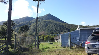
Here is the view of the mountain from the base:
Here is where it looks like you are trespassing:
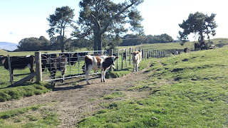
See the fence? And the cows? Next step is to scale the fence, but first Jasper expresses his concern over our instructions:
And now we do what the sign says:
We had to do that a few times, wandering through cow pastures (carefully). You can see another fence crossing here:
The cows were alternately prosaic and epic:
We ascended the first cow-riddled rise and already had a good view back to the lake:
The volcanoes, btw, are on the left edge of that photo. The lake is actually a crater lake from a massive explosion 27,000 years ago. That explosion threw out 750 cu km of ash and pumice. For comparison, Krakatoa in 1883 put only 8 cu km of ash into the atmosphere. Lake Taupo is a big lake.
Here are two photos of pensive children, considering the hike before them:
Here is the end of the pasture part of the hike. The grass is already long and you can see the trees coming:
Before we left the clear area, I took a panoramic photo of Taupo. It is not a big city (23,000 people) and there aren't any tall buildings:
From here, it felt a little bit like hiking through a jungle. Here are assorted hiking/views/jungle photos:
It took us about 2.25 hours to get to the top. That was a bit longer than we anticipated, but the kids were troopers.
Here are some photos from the top:
You can see Taupo through the V of the mountains in that last photo.
Here is a photo along the ridge. You can see a rocky outcrop - I walked out to that point while the kids rested with their mother:
Here is Aidan, "resting":
Here is a view back to the summit from the rocky outcrop:
Jasper was less interested in geology and more interested in his iPod:
We hustled down the mountain. I took a few artful jungle photos. Please resist downloading these photos and entering them in nature-photo competitions. They will win, but that would be stealing.
That was our hike up our mountain. I will feel good looking at it now, being able to say to myself that I've been on top of it. I told the kids to feel the same way.
To close, here is a video from the top:


Looks like you wandered into the trash compacter on the Death Star at one point! ;-) Congrats on crossing your first stiles ("fence crossings")! If you go hiking in the British Isles you will encounter many more of same, plus other fun styles (so to speak) like kissing gates.
ReplyDelete